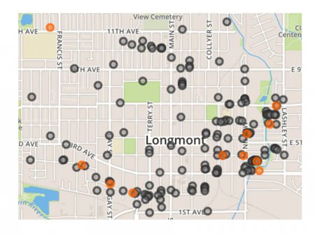
Screen shot of an interactive city map of Longmont, 1965, showing Latino households. On the live map, click on a marker for the address, names of adults, and in some cases their occupations and employers.
Live Map
View Collection Item
Screen shot of an interactive city map of Longmont, 1965, showing Latino households. On the live map, click on a marker for the address, names of adults, and in some cases their occupations and employers.
Live Map
View Collection Item